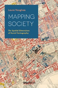
Mapping Society
Laura Vaughan
* Affiliatelinks/Werbelinks
Links auf reinlesen.de sind sogenannte Affiliate-Links. Wenn du auf so einen Affiliate-Link klickst und über diesen Link einkaufst, bekommt reinlesen.de von dem betreffenden Online-Shop oder Anbieter eine Provision. Für dich verändert sich der Preis nicht.
Geisteswissenschaften, Kunst, Musik / Pädagogik
Beschreibung
From a rare map of yellow fever in eighteenth-century New York, to Charles Booth’s famous maps of poverty in nineteenth-century London, an Italian racial zoning map of early twentieth-century Asmara, to a map of wealth disparities in the banlieues of twenty-first-century Paris, Mapping Society traces the evolution of social cartography over the past two centuries. In this richly illustrated book, Laura Vaughan examines maps of ethnic or religious difference, poverty, and health inequalities, demonstrating how they not only serve as historical records of social enquiry, but also constitute inscriptions of social patterns that have been etched deeply on the surface of cities.
The book covers themes such as the use of visual rhetoric to change public opinion, the evolution of sociology as an academic practice, changing attitudes to physical disorder, and the complexity of segregation as an urban phenomenon. While the focus is on historical maps, the narrative carries the discussion of the spatial dimensions of social cartography forward to the present day, showing how disciplines such as public health, crime science, and urban planning, chart spatial data in their current practice. Containing examples of space syntax analysis alongside full colour maps and photographs, this volume will appeal to all those interested in the long-term forces that shape how people live in cities.
Praise for Mapping Society
'Vaughan’s detailed account of social cartography is one that demonstrates not only the functionality of a map, but how cartographic representations can communicate more than just numbers and statistics.'
Society of Cartographers Bulletin
‘Mapping Society is a beautifully produced book, with colour figures throughout rather than relegated to central pages, it gives some background to those iconic maps with which many of us are familiar.’
ianhopkinson.org.uk
'a scholarly and thoroughly researched book that unpicks the context behind many of the foremost examples of social cartography… and reveals how the layout of cities can exacerbate or ameliorate social ills.’
LSE Review of Books
'Explores in detail the huge array of urban social mapping that we think we know from just a few examples'
Mapping as a Process
'an interesting study of the ways in which early social scientists used mapping to consider the spatial ramifications of social issues and how today these maps might be used to shed new light on old problems. Her careful reading of the maps and their spatial dimensions provides new insights into the historical record.'
Imago Mundi: The International Journal for the History of Cartography
Kundenbewertungen
example, sociology, social cartography, geography, problems, Descriptive Map, inhabitants, Survey of London, Jewish East London, prostitution, North Lawndale, living, map of Jewish, urban studies, Rowntree, Maps and Papers, settlement, anthropology, society, fact, Roman Ghetto, Journal, Map of London, History, alleys, city’s, economic, social maps, cholera, W.E.B. Du Bois, Bois, ethnic, East End, Labour, London Poverty, racial, Paris, Chinese, Venice, environment, crime, cartography, citizen science, Snow’s, poverty line, nineteenth century, tenement, housing, Booth, Figure, Sociology, Chinatown, Liverpool, maps of poverty, History of Cartography, Booth’s maps, Press, Kershen, mapping, Asmara, synagogues, space syntax analysis, immigrants, population, graphic, Ghetto, School, disease, statistics, Temperance Movement, Rowntree’s, buildings, Persuasive Cartography, pubs, edited, Hull-House Maps, Geography, Jews, Collection of Persuasive, spatial patterns, Chapter, Charles Booth’s, University of Chicago, district, Venice Ghetto, Chicago, Hillier, layout, clusters, book’s, slum, York, saloons, Detail, organisation, coloured, physical, Hume’s, neighbourhood, Vaughan, blue, poor


