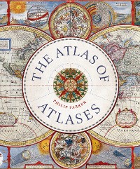
The Atlas of Atlases
Philip Parker
Reise / Karten, Stadtpläne, Atlanten
Beschreibung
This beatutiful book is a lavishly illustrated look at the most important atlases in history and the cartographers who made them.
Atlases are
books that changed the course of history. Pored over by rulers, explorers, and adventures these books were used to
build empires, wage wars, encourage diplomacy, and
nurture trade.
Written by Philip Parker, an authority on the history of maps, this book
brings these fascinating artefacts to life, offering a unique,
lavishly illustrated guide to the history of these incredible books and the cartographers behind them.
All key cartographic works from the last half-millennium are covered, including:
- The Theatrum Orbis Terrarum, considered the world’s first atlas and produced in 1570 by the Dutch, geographer Abraham Ortelius,
- The 17th-century Klencke — one of the world’s largest books that requires 6 people to carry it,
- The Rand McNally Atlas of 1881, still in print today and a book that turned its makers, William H Rand and Andrew McNally into cartographic royalty.
Kundenbewertungen
interesting, asia, Geographers' A–Z Street Atla, maps that changed the world, book of maps, greography, military, non fiction, old maps, present, Andrew McNally, Map, africa, Klencke Atlas, Pergamon World Atlas, longditude, gift for, exploration, jacques cousteau, discovery, gift, for women, discover, globe, naval, south america, oceania, british empire, commerce, maps, atlas,atlases, Atlas Mir, Piri Reis ma, voyage, japan, journeys, dutch empire, historic maps, pictorial, factual, latitude, spanish empire, North American Environmental Atlas, christmas, non-fiction, coffee table book, Times Atlas of the Worl, William H Rand, Rand McNally Atlas, vasco da gama, amerigo vespucci, travel, history, adventurer, nonfiction, charles darwin, david livingstone, christopher columbus, world, merchant, true, National Geographic Atlas of the World, north america, central america, hudson bay, explorer, marco polo, conquistadores, trivia, illustrated, explore, geography, roald admundsen, cartographers, global, vasco de gama, europe, beautiful, catrography, Theatrum Orbis Terrarum, for men


