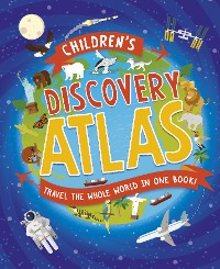
Children's Discovery Atlas
Anita Ganeri
PDF
ca. 14,99 €
Amazon
iTunes
Thalia.de
Hugendubel
Bücher.de
ebook.de
kobo
Osiander
Google Books
Barnes&Noble
bol.com
Legimi
yourbook.shop
Kulturkaufhaus
ebooks-center.de
* Affiliatelinks/Werbelinks
* Affiliatelinks/Werbelinks
Hinweis: Affiliatelinks/Werbelinks
Links auf reinlesen.de sind sogenannte Affiliate-Links. Wenn du auf so einen Affiliate-Link klickst und über diesen Link einkaufst, bekommt reinlesen.de von dem betreffenden Online-Shop oder Anbieter eine Provision. Für dich verändert sich der Preis nicht.
Links auf reinlesen.de sind sogenannte Affiliate-Links. Wenn du auf so einen Affiliate-Link klickst und über diesen Link einkaufst, bekommt reinlesen.de von dem betreffenden Online-Shop oder Anbieter eine Provision. Für dich verändert sich der Preis nicht.
Kinder- und Jugendbücher / Sachbücher / Sachbilderbücher
Beschreibung
A bold and colourful first atlas, packed with illustrations and photos on every page, and covering all areas of the world.
Regions are shown using physical and political maps, and feature iconic animals, natural wonders, famous landmarks, and much more. Each spread includes ‘sight-seeing’ features to whet young explorers’ appetites, as well as a Fast Facts panel, great for learning all the top stats at a glance.
Regions are shown using physical and political maps, and feature iconic animals, natural wonders, famous landmarks, and much more. Each spread includes ‘sight-seeing’ features to whet young explorers’ appetites, as well as a Fast Facts panel, great for learning all the top stats at a glance.
Weitere Titel von diesem Autor
Weitere Titel in dieser Kategorie
Kundenbewertungen
Schlagwörter
transport, screen-free, Middle East, landmarks, South America, global, hobbies, world, animals, wildlife, places, stats, sport, North America, Antarctica, habitat, tourism, travel, Europe, first atlas, reference books, tourist, visit, Key Stage 1, globe, land, Asia, Arctic, Key Stage 2, STEM, multi-cultural, countries, maps, natural wonders, cities, oceans, foods, history, seas, borders, geography, nature, statistics, Africa, diversity, map reading, culture, STEAM, cuisine, country, map


